Get a Birds-Eye View Through RTK GPS
Digital Elevation Models are generally done using drones (or UAVs). DEM via drones is best done when there’s a clear view of the site from above, in outdoors settings.
Surveying using lasers can be done indoors or when the terrain or tree cover is a problem for drones, otherwise RTK GPS topography mapping is the go-to choice for a variety of applications.
RTK GPS Topography Maps: Outdoor Surveying
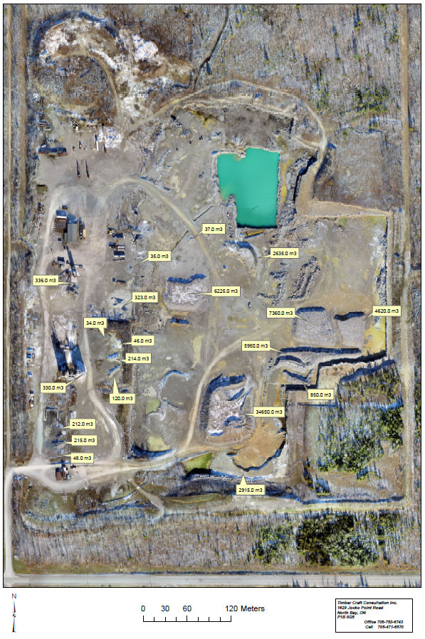
Timbercraft Consulation uses our mapping drones to create georeferenced orthographic aerial maps – using our UAVs, RTK base station and rover, we can take high-accuracy images of terrain and then stitch them together into a mosaic. These orthomosaic maps are usually accurate to within 2.5 to 5 cm.
Learn more about our GIS Data Collection capabilities here.
Certified Drone Operators
Timbercraft Consultation is licensed through Transport Canada to safely operate our drones above people.