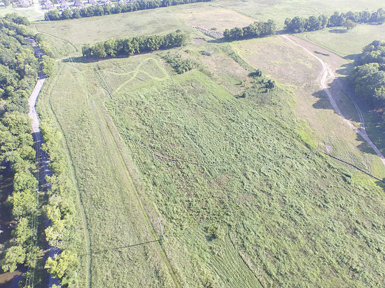
Construction Project Planning: Initial Site Surveying
Construction project planning is made easier with drone-enabled digital elevation models and aerial surveying. Prior to construction, we can produce high resolution topographical maps of your proposed construction site.
We can survey your proposed construction location and provide detailed information on the topography of the area, helping you to identify areas of concern before you begin.
Locate Potential Roadside Quarry Sites
Timbercraft assists aggregates companies with their startups, including finding good locations for potential quarries. Learn more here about our aggregate services. Location scouting can also be applied to your construction projects – we can help you decide between locations for a build.
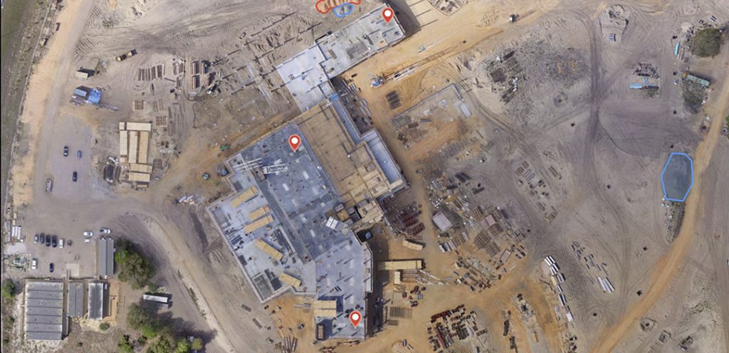
Construction Site Imaging: Monitor Your Progress With Drone Photography and Video
Timbercraft Consultation can fly our drones up close to your construction site safely, to monitor progress on your construction project without you halting work. Our drone photography and video can help you document the work on your construction site, using our 3D mapping software.
Historically this job would have been done using helicopters, but using drones to capture video requires no fuel and results in better-quality footage. Save yourself time and money by employing our UAVs to track your construction job.
Structural Inspections at Construction Sites
Our drones can be deployed to help you inspect the structures you’re building. Do you need a birds-eye view of your building? Drones can be a cost-effective solution. We can inspect vertical surfaces, solar panels, and more.
Worker Safety and Site Security
Monitor the safety and security of your workers, and the construction site itself, with aerial video and aerial photography via our drones. Make sure your equipment is located where you’re expecting it, and check out the security of your remote locations.
Construction Project Planning: Intersection and Corridor Mapping
If your construction project is adjacent to a road or highway, our experience with corridor mapping may be useful in helping you select a construction site. Learn more about our corridor work here.
Cut and Fill Calculation
If your build requires the use of Cut and Fill techniques, we can help you survey, map, and calculate the volumes needed at your site for a smooth transition. More about Cut and Fill quantity calculations can be found here.
Environmental Compliance Documentation
Drones can be brought in to help you prove your environmental compliance, track remediation efforts, survey and map trouble areas etc. Explore our environmental services on this page.
Timbercraft has worked with Miller Paving, Tomlinson’s, Pioneer Construction, Iam Gold Mining, Dennison Mines, Parks Ontario, and the Ministry of Natural Resources. Our extensive experience with UAV piloting means we can offer you a safe and cost-effective means of documenting your construction project in the works.